
1.2: The Celestial Sphere


- Last updated
- Oct 25, 2021
- Save as PDF
( \newcommand{\kernel}{\mathrm{null}\,}\)
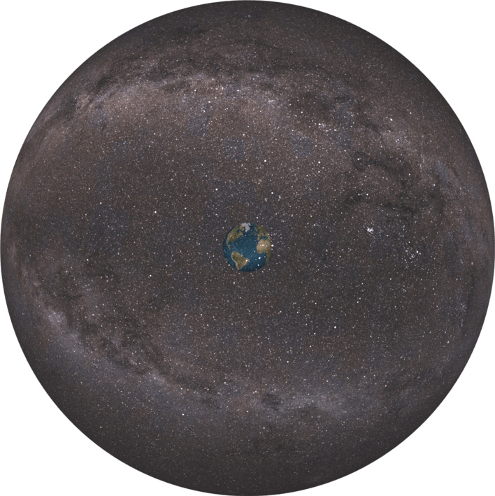 Celestial Sphere - Earth Stars.png; by ChristianReady is licensed under CC BY-SA 4.0
Looking up at the sky and watching the Sun, the Moon, and the stars go by, it’s easy to think that we are at the center of the universe, that everything revolves around our little world. Indeed, that is how most people throughout human history thought things were. They saw the Earth as the center of all things. Being the center of all creation made Earth a special place. The Sun, the Moon, and the five known planets all revolved around the world. Somewhere beyond Saturn, was the Firmament or Vault or Heaven where the stars resided. Some people saw the Firmament as a literal dome or sphere where the stars hung. They considered this celestial sphere to be a real, physical structure and all the stars were more or less the same distance from Earth.
Of course, today we know there is not physical celestial sphere and that the stars are much further away from us than ancient thought. In fact, they are not all equidistant from us. Stars that appear to be close together in the sky may in fact be hundreds or thousands of light-years away when we consider them in three dimensions. They only appear to be close together because they happen to be in roughly the same line of sight from our vantage point. Think of an optical illusion that makes two objects look close together even when they are in fact, far apart.

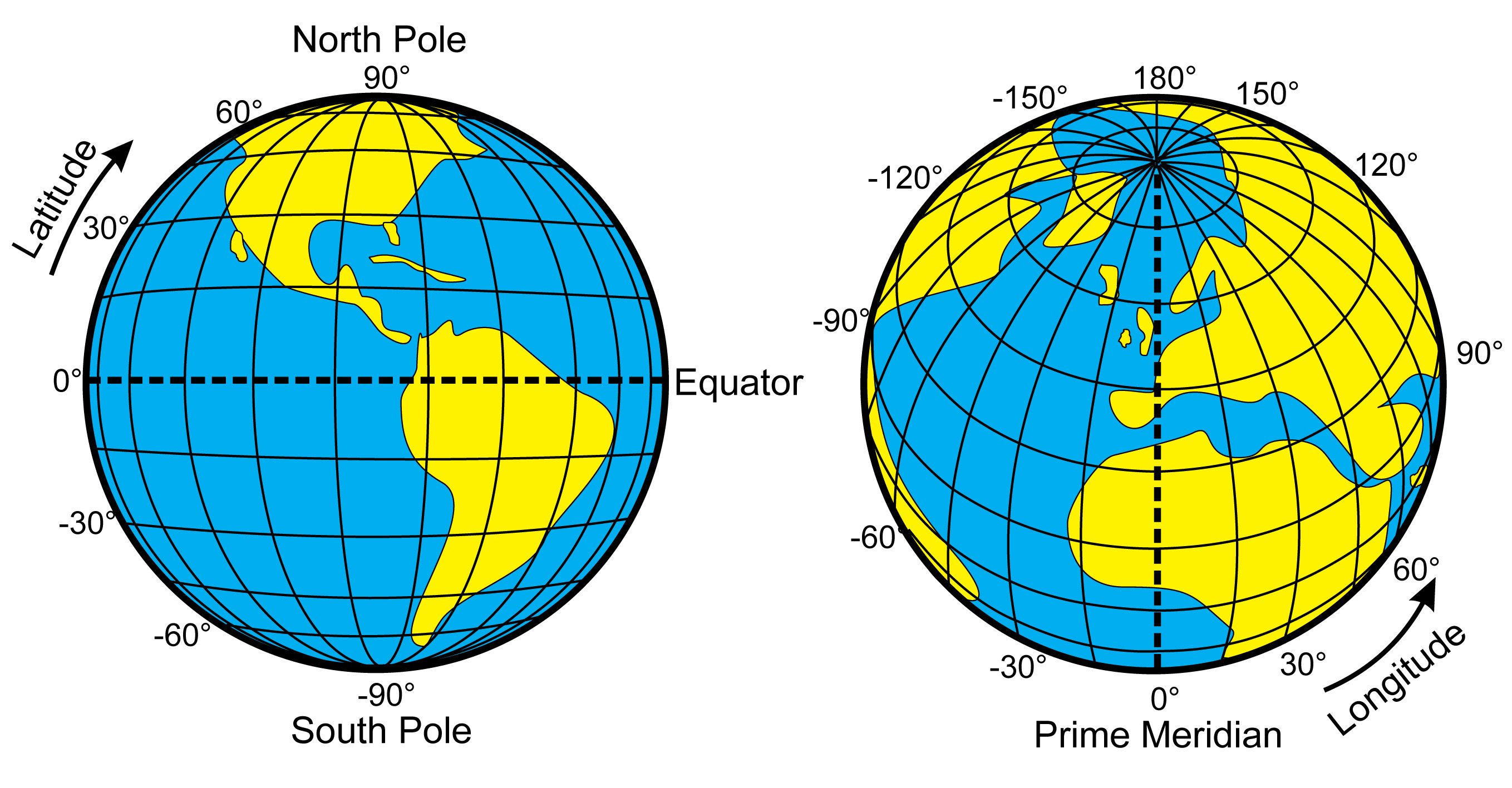
Even though there is no real celestial sphere with stars embedded on its inner surface, the celestial is still a useful model for a coordinate system to locate stars and planets that we want to study. After all, we cannot study an object if we cannot find it. On Earth, we use the system of latitude and longitude to mark a position on the surface of the planet. As with any coordinate system, we need to define a few points of reference from which we can measure our relative position. Latitude is measured in terms of degrees north or south of the equator. On the other hand, longitude is measured in terms of degrees east or west of the prime meridian, an imaginary line that passes through Greenwich, England.
For our celestial sphere model, we need a similar set of coordinates, but one that is placed on the inside of our sphere. But before we examine our stellar coordinate system, let’s ask ourselves, are there any short cuts we can use to help us find objects in the sky? If we were looking for New York City on a globe, we might have start at the equator or prime meridian if we know that New York is on the continent of North America. That would help narrow down our search.
There are no continents in the sky, but there are groups of stars that appear to belong together. Ancient people put stars into groupings they called constellations (Greek for “stars together”). They gave the constellations various names based on mythic heroes and beasts of legend. Often, they told stories about the characters the constellations represented. Today, astronomers still use constellations, but define them a little differently. In the modern terminology, the constellations represent 88 defined regions in the sky that are often used to help us find objects we want to study. For example, if you want to study the Crab Nebula, it helps to know that it is in the constellation Cancer.
_Art.jpg?revision=1)

What sort of coordinate system can we use on our imaginary celestial sphere? An easy starting point might be u
sing the zenith, or point directly overhead of our observer, and define the horizon as all the points on a circle that are 90 degrees down from the zenith. The horizon can then serve as our “latitude.” We can then draw an imaginary arc connecting the cardinal north and south directions and passing through the zenith. We can call this arc the celestial meridian and use it as our starting point for our celestial “longitude.” Therefore, we can define the location of any object in the sky as a certain number of degrees above the horizon (altitude) and a certain number of degrees east or west of the meridian (azimuth).
This is a very simple and useful method for locating objects and it is very intuitive for anyone familiar with the latitude and longitude system of coordinates. There is just one problem with it: the position of any object in the sky varies with the location of the observer. If you measure the altitude and azimuth of an object in the sky
from say, Arizona, and then call a friend in Seattle and give them your coordinates, they won’t find that same object at those coordinates!
Look at something simple as the Zenith. If you were standing on the North Pole and looked straight up, you would see the North Star, Polaris, right near your zenith. That is because you would be standing directly underneath the North Celestial Pole, the point in the sky above the North Pole. However, for an observer on the equator, they would not see Polaris right above their head. Instead, Polaris would be down at the horizon if it were visible at all. That is because they are 90 degrees south of the North Pole, so the North Celestial Pole would be 90 degrees away from their zenith. Worse, an observer in the southern
hemisphere cannot see Polaris at all, as it would be below their horizon. Note that there is also a South Celestial Pole, which is defined as the point in the sky that is directly above the South Pole and can only be defined for observers in the southern hemisphere. Therefore, what constellations we see depend on our location, the number of degrees north or south of the equator we are and the time of year. For example, Orion is considered a winter constellation because it seen during the winter months in the Northern Hemisphere.
 The Celestial Sphere: https://www.subpng.com/png-2mp4li/
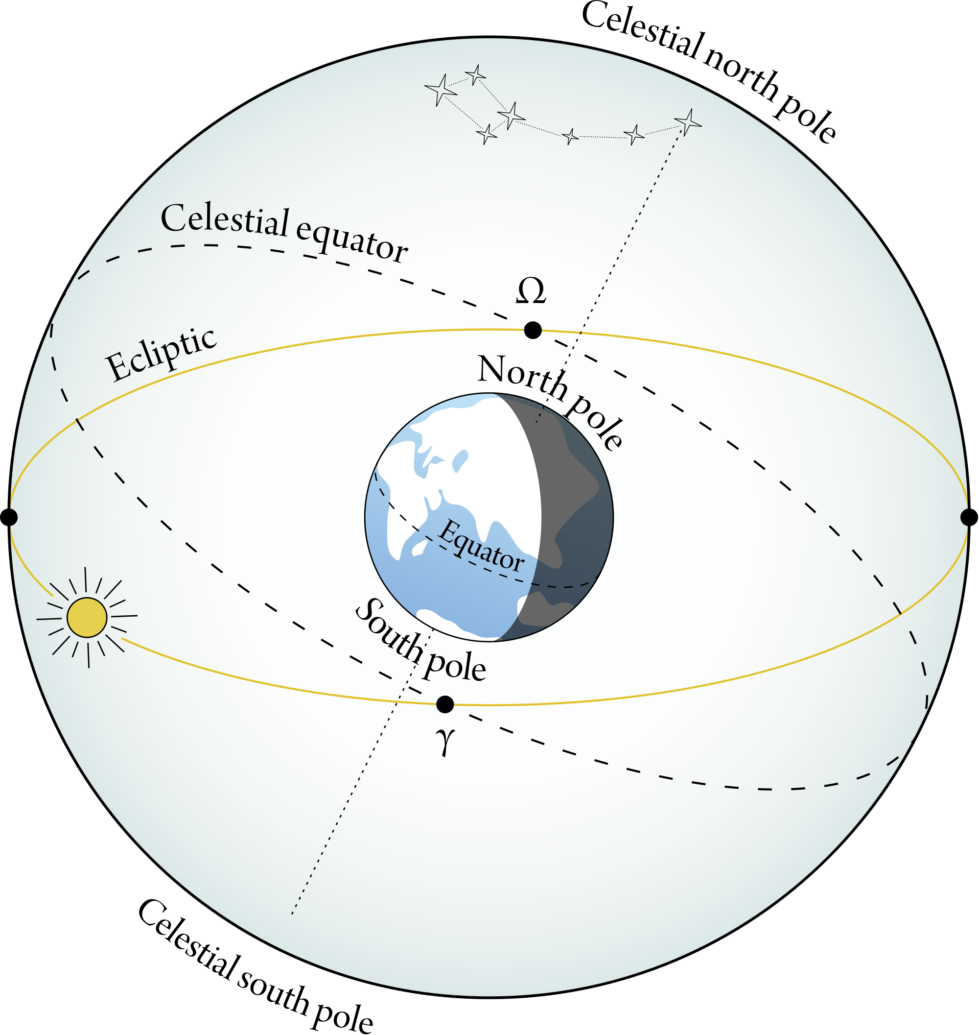
So, instead of using the horizon and the celestial meridian as our references, we are going to pick reference points that can be used no matter where the observer is on Earth. The first reference we are going to use it the celestial equator, which is the projection of the Earth’s equator onto our celestial sphere. We use the term declination to mean the number of degrees north or south of the celestial equator. The advantage of using the celestial equator is that it moves with the relative position of the stars from one location on Earth to another. This makes it a portable reference that can be applied anywhere on Earth. For more precise measurements, declination is given in degrees, arcminutes, and arcseconds, where an arcminute is 1/60th of a degree and an arcsecond is 1/60th of an arcminute. Degrees, arcminutes, and arcseconds are also used to measure the apparent size of an object. For example, viewed from Earth, the Moon has an apparent size of 31 arcminutes or roughly half a degree.
The other reference in our celestial coordinate system uses the ecliptic, which is defined as the apparent path the Sun makes as it moves across the sky during the day (Astronomers also use the term ecliptic to mean the plane of the Earth’s orbit as it revolves around the Sun). This measurement is called right ascension and is defined not using degrees but in the number of hours, minutes, and seconds from the Sun’s position on the vernal equinox. Using declination and right ascension, we can then pinpoint the location of an object on our celestial sphere than can be translated in any local altitude and azimuth.
 The Celestial Equator, Ecliptic, and Celestial Poles.
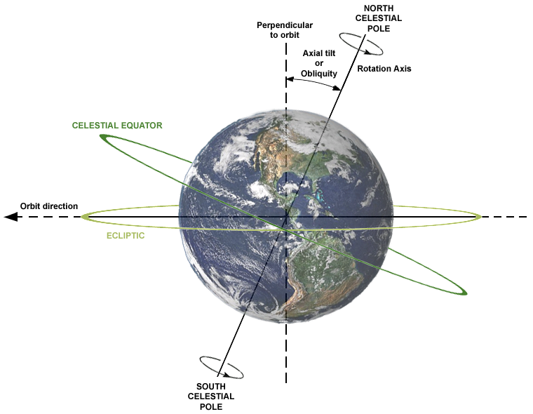
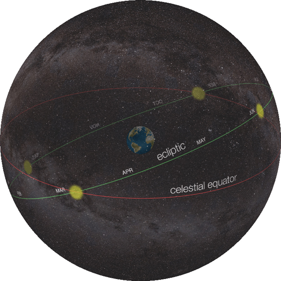 The Celestial Sphere with the ecliptic and celestial equator.
"File:Celestial Sphere - Eq Ecliptic.png" by ChristianReady is licensed under CC BY-SA 4.0
